Turramurra's name comes from an Aboriginal word meaning "big hill", and the suburb sits high on the Pacific Highway ridge. The Dictionary of Sydney notes that Turramurra and other elevated parts of the north shore get the highest rainfall in metropolitan Sydney. Put that rain on deep shale clay and you get the two things that shape gardens here: big trees and drainage problems.
This guide is part of my series on North Shore suburbs. I've overlaid the Turramurra suburb boundary on the NSW Government's soil and vegetation maps to see what was here before clearing.
What grew in Turramurra before 1788
| Plant community | Share of the suburb |
|---|---|
| Blue Gum High Forest | about 53% |
| Sydney Coastal Enriched Sandstone Forest | about 15.6% |
| Sydney Turpentine Ironbark Forest | about 15.4% |
| Sydney Enriched Sandstone Moist Forest | about 7.3% |
| Sydney Coastal Shale-Sandstone Forest | about 5% |
| Sydney Coastal Sandstone Bloodwood Shrub Forest | about 2% |
Blue gum high forest on the ridge
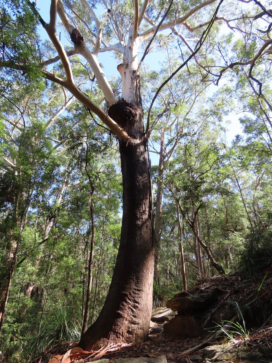
Just over half of Turramurra was Blue Gum High Forest: Sydney blue gum (Eucalyptus saligna) and blackbutt (Eucalyptus pilularis) on deep shale soil. It's critically endangered in NSW and nationally, with about 99% cleared. Tall blackbutts like this one still stand in parts of Turramurra.
Sandstone forest on the slopes
Off the ridge, especially in the south-west towards the Lane Cove valley, the shale gives way to sandstone, and the forest changed to Sydney red gum (Angophora costata), red bloodwood and Sydney peppermint, with moist forest in the gullies. About 5% was Sydney Coastal Shale-Sandstone Forest, a tall forest with a grassy ground layer that grows on sandstone crests with some clay influence. The NSW Government estimates about 69% of that community has been cleared.
My which plant community guide explains how to work out which of these your block belonged to.
Turramurra soil type: the big hill
| Soil landscape | Share of the suburb | Rock underneath | What it's like |
|---|---|---|---|
| Glenorie | about 55% | Wianamatta shale | Friable loam over deep red and yellow clay. Acidic, moderately reactive, waterlogs in places |
| Lucas Heights | about 14% | Mittagong Formation | Hard-setting yellow clay soils, stony, low fertility, holds little water |
| Gymea | about 13% | Hawkesbury Sandstone | Sandy soils with rock benches, permeable, very low fertility |
| Hawkesbury | about 8% | Hawkesbury Sandstone | Steep, rocky, shallow sand, extreme erosion hazard |
| West Pennant Hills | about 5% | Shale and shale colluvium | Steep slopes, deep clay, mass movement hazard, plastic shrink-swell subsoil |
| Lambert | about 3.5% | Hawkesbury Sandstone | Shallow sandy soils on exposed ridges, very low fertility |
| Hornsby | about 1.5% | Volcanic breccia | Deep clay soils on weathered volcanic rock, highly reactive subsoil |
What that means in the garden
On the ridge (Glenorie): the soil survey actually uses Turramurra as an example of urban development on the Glenorie landscape. It describes a friable dark brown loam, up to about 15 cm deep on the crests, over deep reddish-brown and then mottled grey clay. It measured the topsoil at about pH 5.0 to 6.0 and the clay at about pH 4.0 to 5.5, and notes localised seasonal waterlogging. Add Turramurra's rainfall and you get wet, heavy soil in winter. Raised beds, mulch on top and plants that tolerate wet feet all help.
On the steep shale slopes (West Pennant Hills): the survey names Turramurra as one of the places where this landscape runs along the highway ridge. It's deep, plastic clay with a mass movement hazard. Take care with cuts, retaining walls and where stormwater goes.
In the south-west (Lucas Heights, Hawkesbury and a little Hornsby): towards the Lane Cove valley, the soil changes fast. Lucas Heights soil is a hard-setting, stony yellow clay with low fertility. Hawkesbury soil is shallow sand over rock. And there's a small patch of the Hornsby landscape, deep clay on weathered volcanic rock with a highly reactive subsoil. Two neighbours a few streets apart can have very different soil.
How the 1800s changed Turramurra's soil
Timber-getters were working the area from 1822, and the land was used mainly for timber until the 1840s. Large grants went to Thomas Hyndes in 1838, east of Lane Cove Road, and Thomas Boyd in 1839, on the western side. Once the valuable timber was gone, farmers set up farms and citrus orchards. After Hyndes died, his estate was broken up in 1855 into small orchards. Produce and timber went by bullock track to the Lane Cove River, then by barge to Sydney.
The railway opened on 1 January 1890, with the station first called Eastern Road. It was renamed Turramurra that December. With fast transport, farmers switched to fruit and vegetables that wouldn't survive the rough roads: plums, peaches, strawberries and tomatoes. By 1920, citrus disease and fruit fly had ended commercial fruit growing on the north shore. Some orchardists leased their land to Chinese market gardeners. The population went from 142 in 1881 to 1,306 in 1901, and large blocks were subdivided between 1910 and 1920.
What that meant for the soil:
- Timber-getting removed the blue gum forest that had built Turramurra's best soil.
- Citrus orchards, then fruit and vegetables, then market gardens kept the cleared clay under cultivation for decades.
- Subdivision after the railway, especially between 1910 and 1920, turned the farms and orchards into house blocks and gardens.
Turramurra gardens today
Heritage conservation areas
The council lists three heritage conservation areas in Turramurra: Bobbin Head Road, Hillview and Ku-ring-gai Avenue. It also lists the Laurel Avenue King Street area, which crosses into Warrawee. Ku-ring-gai Avenue has some of the suburb's best-known houses, including Glensloy, also known as Wychwood, in the Queen Anne style.
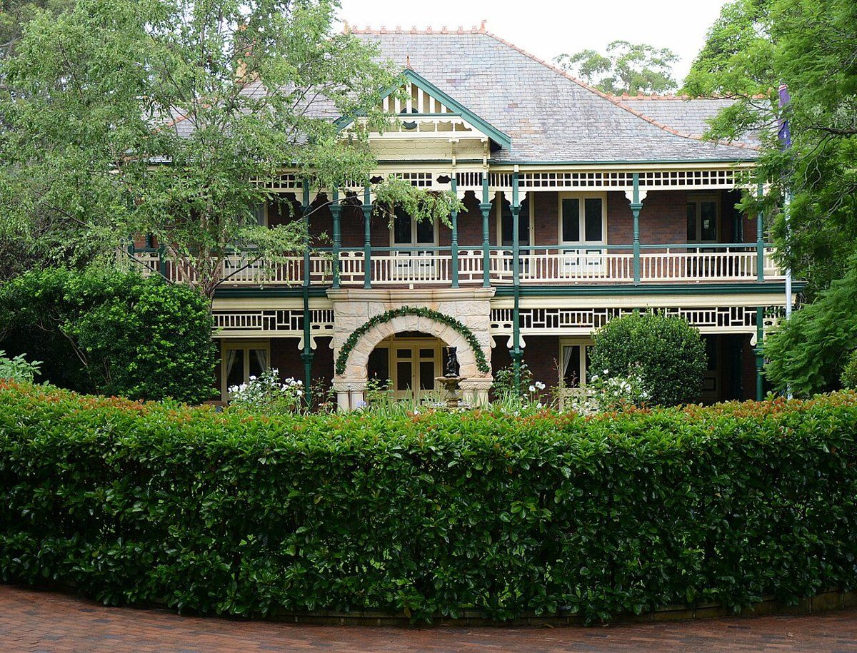
The council notes that fences, trees and gardens contribute to a conservation area's significance. If you're redoing a garden in one of these areas, my heritage and classic gardens guide covers period-appropriate planting.
Parks, bush and big trees
The Dictionary of Sydney counts more than 25 parks, reserves and playing fields in Turramurra, including Turramurra Forest, Lower Dam Forest, Twin Creeks Reserve and Upper Cowan Creek Reserve. Many gardens back onto them. If you're deciding on a style that sits well next to the bush, my garden styles guide is a good place to start.
Working on your garden in Turramurra
I work across Sydney's North Shore, including Turramurra (see my Ku-ring-gai area page). Nearby suburbs in this series are South Turramurra, North Turramurra, Warrawee and Pymble.
Sources
- NSW DCCEEW, State Vegetation Type Map, pre-1750 Plant Community Types (map service VIS/SVTM_NSW_1750_PCT), queried 13 Oct 2026
- NSW Spatial Services, NSW Administrative Boundaries, Suburb layer (Turramurra, 601 ha)
- BioNet Vegetation Classification, PCT definitions 3136, 3262, 3592 and 3259
- NSW Threatened Species profile, Blue Gum High Forest in the Sydney Basin Bioregion
- NSW Threatened Species profile, Sydney Turpentine-Ironbark Forest in the Sydney Basin Bioregion
- NSW DCCEEW, Soil Landscapes of the Sydney 1:100,000 Sheet (Chapman & Murphy 1989; map ed. 4, 2009), map service Soil_Landscape/Sydney queried 13 Oct 2026
- NSW DCCEEW eSPADE, Glenorie (gn) soil landscape report, from Chapman & Murphy 1989
- NSW DCCEEW eSPADE, Lucas Heights (lh) soil landscape report, from Chapman & Murphy 1989
- NSW DCCEEW eSPADE, Gymea (gy) soil landscape report, from Chapman & Murphy 1989
- NSW DCCEEW eSPADE, West Pennant Hills (wp) soil landscape report, from Chapman & Murphy 1989
- NSW DCCEEW eSPADE, Hornsby (ho) soil landscape report, from Chapman & Murphy 1989
- Rowland J, Turramurra, Dictionary of Sydney, 2011
- "Ku-ring-gai Council, Heritage conservation areas (list of HCAs by suburb, history of the listings, and note that fences, trees and gardens contribute to significance), read 13 Oct 2026