
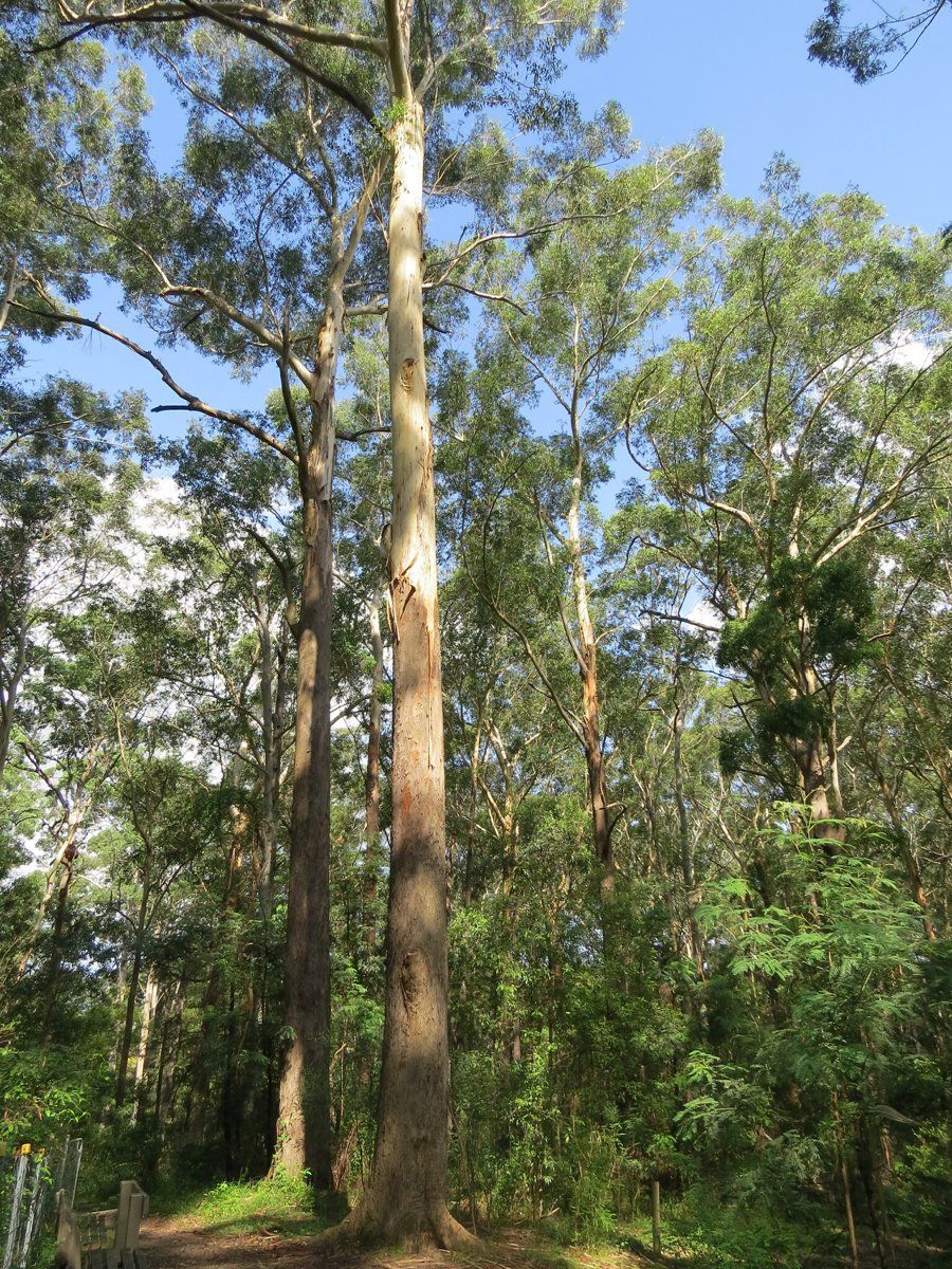
Pymble sits right on the Pacific Highway ridge between Gordon and Turramurra, and about two-thirds of it is deep shale clay. That clay grew tall blue gum forest, then orange orchards, and since the 1880s some of Ku-ring-gai's best-known gardens.
This guide is part of my series on North Shore suburbs. I've overlaid the Pymble suburb boundary on the NSW Government's soil and vegetation maps to see what was here before clearing.
What grew in Pymble before 1788
| Plant community | Share of the suburb |
|---|---|
| Blue Gum High Forest | about 58.5% |
| Sydney Turpentine Ironbark Forest | about 27% |
| Sydney Enriched Sandstone Moist Forest | about 7% |
| Sydney Coastal Sandstone Bloodwood Shrub Forest | about 4% |
| Sydney Coastal Enriched Sandstone Forest | about 1.6% |
| Sydney Coastal Sandstone Gully Forest | about 1.5% |
Blue gum and blackbutt on the ridge
The ridge and its upper slopes were Blue Gum High Forest: Sydney blue gum (Eucalyptus saligna) and blackbutt (Eucalyptus pilularis) over a soft, shrubby understorey. It's critically endangered in NSW and nationally, and about 99% of it has been cleared.
Turpentine and ironbark lower down
Just over a quarter of Pymble was Sydney Turpentine-Ironbark Forest, which BioNet describes as growing on shale or sheltered shale-sandstone soils. It's also critically endangered. Further down, towards Blackbutt Creek and the Lane Cove valley, the soil turns sandy and the vegetation changes to sandstone forest, including moist forest in the sheltered gullies.
If you want to work out which of these communities your block belonged to, my which plant community guide walks through it.
Pymble soil type: deep clay on the ridge
| Soil landscape | Share of the suburb | Rock underneath | What it's like |
|---|---|---|---|
| Glenorie | about 65% | Wianamatta shale | Friable loam over deep red and yellow clay. Acidic, moderately reactive, waterlogs in places |
| Lucas Heights | about 15% | Mittagong Formation | Hard-setting yellow clay soils, stony, low fertility, holds little water |
| West Pennant Hills | about 8.6% | Shale and shale colluvium | Steep slopes, deep clay, mass movement hazard, plastic shrink-swell subsoil |
| Hawkesbury | about 6.4% | Hawkesbury Sandstone | Steep, rocky, shallow sand, very low fertility |
| Gymea | about 4.8% | Hawkesbury Sandstone | Sandy soils with rock benches, permeable, very low fertility |
What that means in the garden
On the ridge (Glenorie): a friable dark brown loam, up to about 15 cm deep on the crests, over reddish-brown clay. The survey measured the topsoil at about pH 5.0 to 6.0 and the clay at about pH 4.0 to 5.5, and it rates the clay as moderately reactive. It holds water well, so most problems here are about drainage, not drought. Lift beds where water sits, and keep the surface mulched because the topsoil can set hard when compacted.
On the steep shale slopes (West Pennant Hills): the soil survey names Pymble as one of the places on the highway ridge where this landscape occurs, on steep, mostly south-west-facing slopes. The clay is deep, impermeable and plastic, and the survey rates it as a mass movement hazard. On these blocks I'd keep big cuts and concentrated runoff away from slopes and get advice before building retaining walls.
On the transition (Lucas Heights): where the shale gives way to the Mittagong Formation, the soil is a hard-setting yellow clay, often stony, with low fertility and not much water-holding capacity. It needs organic matter on top, more water in summer and patience.
How the 1800s changed Pymble's soil
Pymble is named after a Hertfordshire silk-weaver who arrived in Sydney as a free settler in 1821 and received a 600-acre grant in June 1823. He hired convict labour to clear the forest. By 1828 he had cleared 10 acres east of Lane Cove Road, sold the timber to lumberyards and planted three acres of orange orchards.
His grandson, JG Edwards, described early Pymble as "a few paddocks of oats, a few humble houses, and a couple of magnificent orangeries and beyond that, trees."
Parts of Pymble were subdivided in the early 1880s in anticipation of the North Shore railway, and the major subdivisions came between 1879 and 1900. One estate advertisement sold the district on "beautiful gardens, ground and orchards backed by masses of natural forest". A 1915 prospectus for the Pymble Grove Estates called it a centre of beautiful homes and gardens.
What that meant for the soil:
- Clearing for timber, sold to Sydney lumberyards, removed the blue gum and turpentine forest that had built the soil.
- Oats and orange orchards meant years of cultivating the clay topsoil, which the survey rates as a high erosion hazard when exposed.
- Subdivision from the 1880s turned paddocks and orchards into large house blocks and gardens.
Pymble gardens today
Eight heritage conservation areas
The council lists eight heritage conservation areas in Pymble: Athol, Fernwalk, Mona Vale Road, Orinoco Street, Park Estate, Pymble Avenue, Pymble Heights and Telegraph Road. The council notes that fences, trees and gardens contribute to an HCA's significance. Notable houses include Grandview (about 1880), Merrivale (1930) and the Pratten House on Telegraph Road, designed by Walter Burley Griffin in 1935.
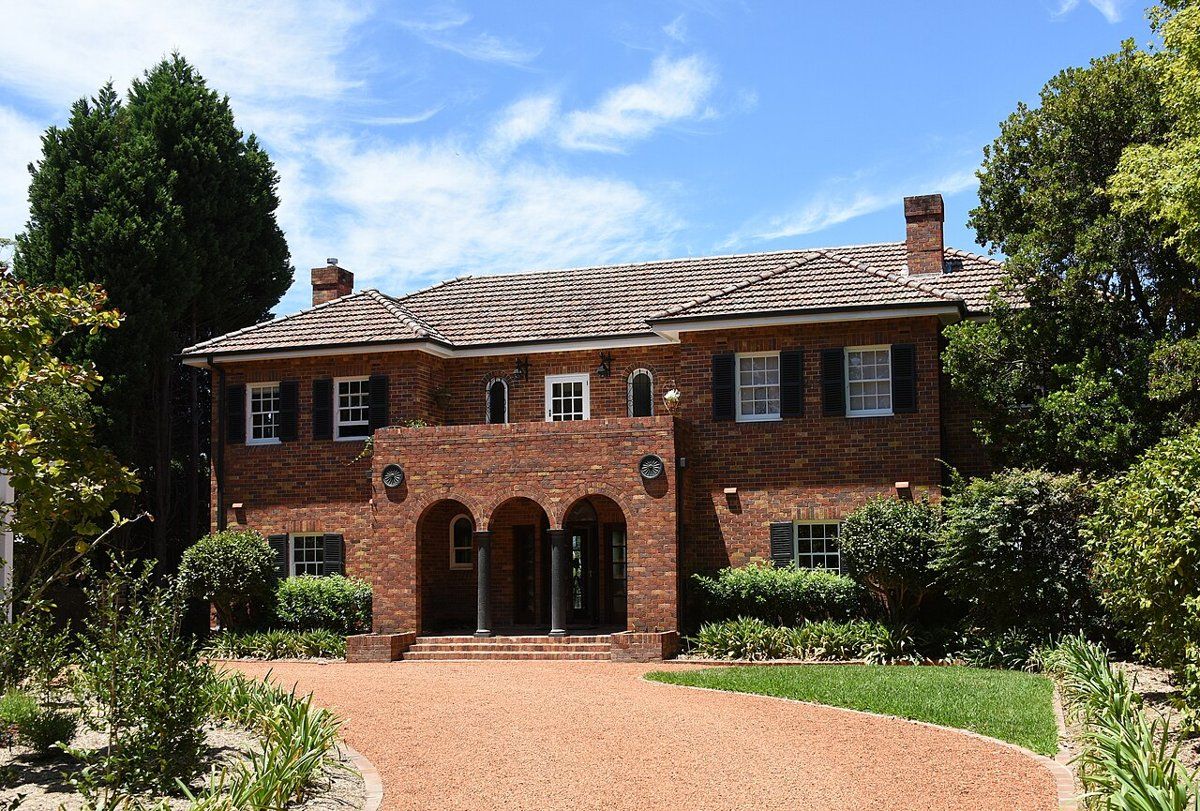
If you're restoring or replanting a garden in one of these areas, my heritage and classic gardens guide covers period-appropriate plants and layouts, and my council rules guide explains what needs approval.
Gardens on clay
Pymble's deep clay can carry big trees and generous shrub borders. The usual problems are wet spots, compacted lawns and roots under pressure from building work. Getting drainage right before planting saves a lot of trouble later.
Working on your garden in Pymble
I work across Sydney's North Shore, including Pymble (see my Ku-ring-gai area page). Nearby suburbs in this series are West Pymble, Gordon, Turramurra and St Ives.
Sources
- NSW DCCEEW, State Vegetation Type Map, pre-1750 Plant Community Types (map service VIS/SVTM_NSW_1750_PCT), queried 13 Oct 2026
- NSW Spatial Services, NSW Administrative Boundaries, Suburb layer (Pymble, 652 ha)
- BioNet Vegetation Classification, PCT definitions 3136, 3262 and 3176
- NSW Threatened Species profile, Blue Gum High Forest in the Sydney Basin Bioregion
- NSW Threatened Species profile, Sydney Turpentine-Ironbark Forest in the Sydney Basin Bioregion
- NSW DCCEEW, Soil Landscapes of the Sydney 1:100,000 Sheet (Chapman & Murphy 1989; map ed. 4, 2009), map service Soil_Landscape/Sydney queried 13 Oct 2026
- NSW DCCEEW eSPADE, Glenorie (gn) soil landscape report, from Chapman & Murphy 1989
- NSW DCCEEW eSPADE, Lucas Heights (lh) soil landscape report, from Chapman & Murphy 1989
- NSW DCCEEW eSPADE, West Pennant Hills (wp) soil landscape report, from Chapman & Murphy 1989
- NSW DCCEEW eSPADE, Hawkesbury (ha) soil landscape report, from Chapman & Murphy 1989
- Edwards Z, Pymble, Dictionary of Sydney, 2010
- "Ku-ring-gai Council, Heritage conservation areas (list of HCAs by suburb, history of the listings, and note that fences, trees and gardens contribute to significance), read 13 Oct 2026