
West Pymble sits below Pymble, on the slopes running down to the Lane Cove River. The Dictionary of Sydney puts it at 18 to 111 metres above sea level, compared with up to 182 metres for Pymble on the ridge. That drop explains most of what's different about gardening here: more sandstone, more bush and more slope.
This guide is part of my series on North Shore suburbs. I've overlaid the West Pymble suburb boundary on the NSW Government's soil and vegetation maps to see what was here before clearing.
What grew in West Pymble before 1788
| Plant community | Share of the suburb |
|---|---|
| Sydney Turpentine Ironbark Forest | about 49% |
| Sydney Coastal Enriched Sandstone Forest | about 17% |
| Sydney Coastal Sandstone Gully Forest | about 14% |
| Sydney Enriched Sandstone Moist Forest | about 11% |
| Northern Sydney Scribbly Gum Woodland | about 3.4% |
| Sydney Coastal Shale-Sandstone Forest | about 3.1% |
| Sydney Coastal Coachwood Gallery Rainforest | about 1.8% |
Turpentine-ironbark forest on the higher ground
About half the suburb was Sydney Turpentine-Ironbark Forest, which BioNet describes as growing on shale or sheltered shale-sandstone soils. It's critically endangered in NSW and nationally, and the NSW Government estimates about 96% of it has been cleared.
In 1805 the botanist George Caley described stands of blackbutt, turpentine, stringybark, ironbark, blue gum and mahogany on the upper north shore, particularly on the deep shale soils.
Sandstone forest towards the river
Below that, the slopes were sandstone forest. On the drier, more open ground that meant Sydney red gum (Angophora costata), red bloodwood (Corymbia gummifera) and Sydney peppermint (Eucalyptus piperita). The sheltered gullies held moister forest, and along the creeks there was a little coachwood rainforest, a community the NSW Government describes as growing along streams between Ku-ring-gai Creek and the Parramatta River.
A small share of the ridgetops was Northern Sydney Scribbly Gum Woodland, a heathy woodland of scribbly gum (Eucalyptus haemastoma) with banksias and other shrubs.
Much of this sandstone vegetation still survives in Lane Cove National Park and the reserves along Blackbutt Creek. My which plant community guide explains how to work out which community your block once belonged to.
West Pymble soil type: mostly sandstone
| Soil landscape | Share of the suburb | Rock underneath | What it's like |
|---|---|---|---|
| Gymea | about 37% | Hawkesbury Sandstone | Sandy soils with rock benches, permeable, very low fertility |
| Glenorie | about 25% | Wianamatta shale | Friable loam over deep red and yellow clay. Acidic, moderately reactive |
| Hawkesbury | about 19.5% | Hawkesbury Sandstone | Steep, rocky, shallow sand, extreme erosion hazard |
| Lucas Heights | about 19% | Mittagong Formation | Hard-setting yellow clay soils, stony, low fertility, holds little water |
What that means in the garden
On the sandstone slopes (Gymea and Hawkesbury): this is most of West Pymble. The soil survey describes Gymea soils as sandy, highly permeable and very low in nitrogen and phosphorus, with very poor fertility. Hawkesbury soils on the steepest ground are shallow and rocky, with an extreme erosion hazard. The topsoil is commonly water repellent, so water runs off when it's dry.
In practice: local natives are the easiest plants here. They're adapted to low phosphorus, so go easy on fertiliser. Keep mulch on to slow runoff, and use a wetting agent if water beads on the surface. My native plant finder can help you choose plants that suit sandy soil.
On the higher ground (Glenorie and Lucas Heights): on the higher ground in the north and east of the suburb, towards Pymble and Gordon, there's clay. Glenorie clay is deep, holds water and drains slowly. Lucas Heights soil is a hard-setting, often stony, yellow clay with low fertility. Both benefit from organic matter worked into the surface and from mulch.
Volcanic rock under the park
West Pymble also has a geological oddity. The old Lofberg quarry, now Ku-ring-gai Bicentennial Park, cut into volcanic rock that had been forced into the sandstone. The geologist DF Branagan described it as "the best exposed sill (horizontal intrusion of volcanic rock) in the Sydney region", with two exposed dykes and sandstone that had formed prisms from the heat.
How the 1800s changed West Pymble's soil
Between 1810 and the late 1830s, timber-getters felled the largest trees in the district and set up sawpits along the ridgeline from Roseville to Wahroonga and above Fidden's Wharf on the Lane Cove River. West Pymble, below the ridge, was selectively logged for the best timber. The logs went by bullock team to the sawpits and then down the Lane Cove River to Sydney. Once the big trees were gone, firewood cutters and charcoal burners worked over what was left.
Orchards followed. Between 1840 and 1880, swathes of bushland in the district were cleared for lemons, limes, apples, pears, grapes, plums and peaches. The Lofberg family grew oranges, grapes and strawberries between Ryde and Yanko roads into the 1920s, alongside cattle, pigs and horses. Bushfires, pests, disease and poor farming methods ended most of the orchards, with codling moth and fruit fly hitting hard by the early 1900s.
What that meant for the soil:
- Selective logging, then firewood and charcoal cutting stripped the canopy and the timber that protected the slopes.
- Clearing for orchards removed much of the remaining bush on the workable ground.
- Quarrying removed the rock altogether in one part of the suburb. From 1926 the council ran the quarry, and by 1930 it was producing 80,000 tonnes of rock a year.
West Pymble gardens today
A late, steep suburb
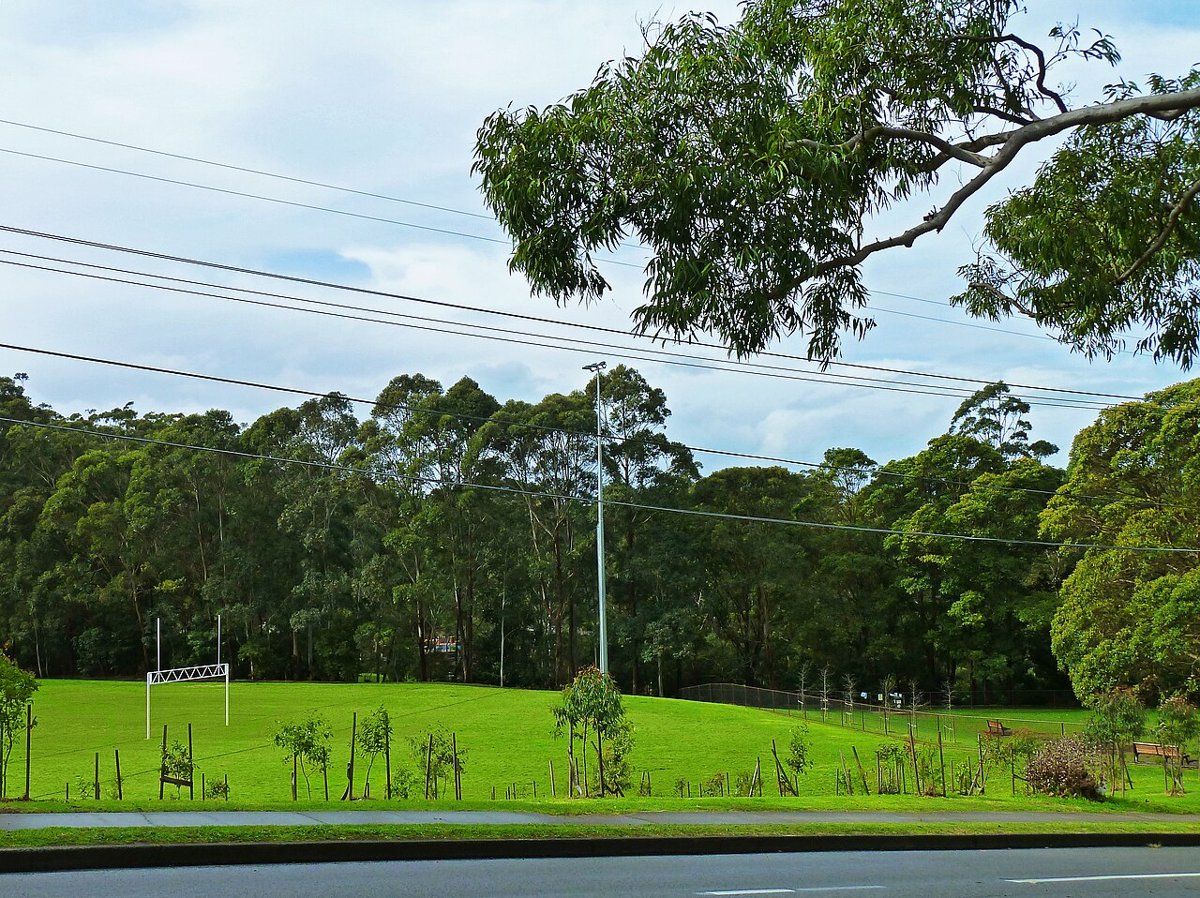
The Dictionary of Sydney says building in West Pymble was slowed partly by the cost of building and draining its uneven, and in parts steep, ground. A 1943 aerial photo still showed rows of fruit trees in several streets. Most of the houses came in the 1950s and 1960s, as bigger holdings were subdivided, and from the late 1990s many were renovated and extended.
On sloping sandstone blocks like these, retaining walls, drainage and soil depth are the things I'd check first.
Living next to the bush
The suburb is bounded by the Lane Cove River and by Blackbutt and Troon creeks, so a large share of its blocks back onto bushland. Escaped garden plants are the big problem along these edges. The soil survey notes weeds like privet, lantana, morning glory and wandering jew washing into the valley floors with sediment. My weeds guide covers the worst ones and how to replace them.
Working on your garden in West Pymble
I work across Sydney's North Shore, including West Pymble (see my Ku-ring-gai area page). Nearby suburbs in this series are Pymble, Gordon, Killara and South Turramurra.
Sources
- NSW DCCEEW, State Vegetation Type Map, pre-1750 Plant Community Types (map service VIS/SVTM_NSW_1750_PCT), queried 13 Oct 2026
- NSW Spatial Services, NSW Administrative Boundaries, Suburb layer (West Pymble, 370 ha)
- BioNet Vegetation Classification, PCT definitions 3262, 3592, 3595, 3176 and 3038
- NSW Threatened Species profile, Sydney Turpentine-Ironbark Forest in the Sydney Basin Bioregion
- NSW DCCEEW, Soil Landscapes of the Sydney 1:100,000 Sheet (Chapman & Murphy 1989; map ed. 4, 2009), map service Soil_Landscape/Sydney queried 13 Oct 2026
- NSW DCCEEW eSPADE, Gymea (gy) soil landscape report, from Chapman & Murphy 1989
- NSW DCCEEW eSPADE, Glenorie (gn) soil landscape report, from Chapman & Murphy 1989
- NSW DCCEEW eSPADE, Hawkesbury (ha) soil landscape report, from Chapman & Murphy 1989
- NSW DCCEEW eSPADE, Lucas Heights (lh) soil landscape report, from Chapman & Murphy 1989
- Cameron-Smith B, West Pymble, Dictionary of Sydney, 2012