
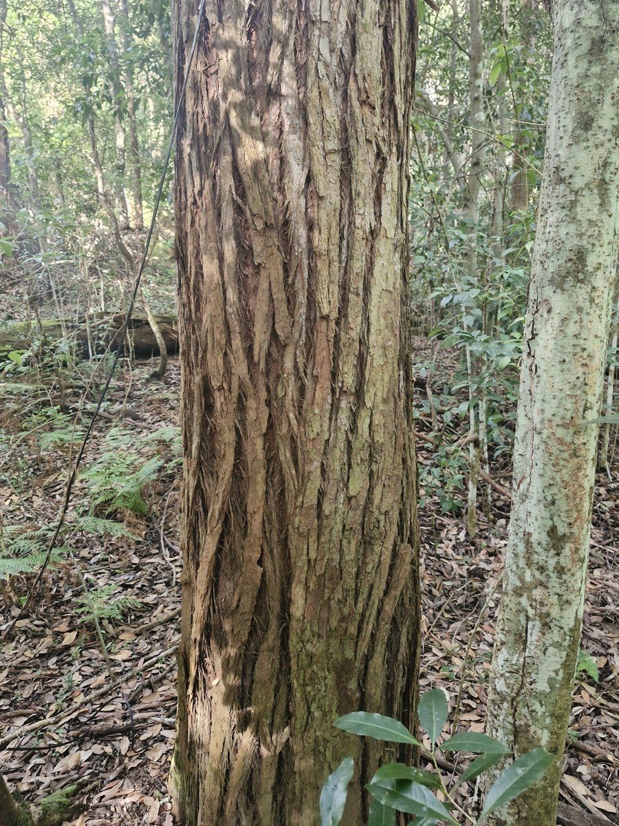
Gordon sits right on the change-over between the shale ridges and the sandstone gullies of Ku-ring-gai, and most of the suburb is on the soil in between. That in-between soil is the key to understanding Gordon gardens. It isn't as rich as the shale on the highest ground, and it isn't the deep sand of the sandstone country either.
This guide is part of my series on North Shore suburbs. For each one I've overlaid the suburb boundary on the NSW Government's soil and vegetation maps to see what the ground was like before clearing and what's happened to it since.
What grew in Gordon before 1788
The state's modelled pre-clearing vegetation map shows Gordon was mostly turpentine country:
| Plant community | Share of the suburb |
|---|---|
| Sydney Turpentine Ironbark Forest | about 42% |
| Blue Gum High Forest | about 22% |
| Sydney Coastal Enriched Sandstone Forest | about 20% |
| Sydney Enriched Sandstone Moist Forest | about 14% |
Sydney Turpentine-Ironbark Forest
This forest grows near the boundary between shale and sandstone, on soils with some shale influence. Turpentine (Syncarpia glomulifera) is the tree that turns up almost every time, sometimes as the main canopy tree and sometimes as a smaller tree underneath. With it you'd find blackbutt (Eucalyptus pilularis), Sydney red gum (Angophora costata), grey gum (Eucalyptus punctata), and less often grey ironbark (Eucalyptus paniculata), white stringybark (Eucalyptus globoidea) and red mahogany (Eucalyptus resinifera). Underneath were sweet pittosporum, native daphne (Leucopogon juniperinus), breynia, mock olive (Notelaea longifolia) and a grassy ground layer of weeping grass, blady grass (Imperata cylindrica) and kangaroo grass.
It's now critically endangered, and only small remnants are left. Gordon is in the part of Sydney where most remnants survive.
Blue Gum High Forest
On the higher shale ground, the turpentine forest gave way to Blue Gum High Forest, a very tall forest of Sydney blue gum (Eucalyptus saligna) and blackbutt. It's also critically endangered, with less than 200 hectares left by 2000.
The sandstone forests
Down the slopes, where the soil is mostly sandstone with a bit of shale washed in, the map shows Sydney red gum with red bloodwood (Corymbia gummifera) and Sydney peppermint (Eucalyptus piperita) over shrubs like hairpin banksia, geebungs and crinkle bush (Lomatia silaifolia). In the sheltered gullies, such as along the creeks that run off the ridge, there was taller moist forest of red gum, turpentine and blackbutt over a deep fern layer.
My which plant community guide will help you work out which of these your block belongs to.
Gordon soil type: mostly the in-between soil
The NSW soil landscape map splits Gordon like this:
| Soil landscape | Share of the suburb | Rock underneath | What it's like |
|---|---|---|---|
| Lucas Heights | about 46% | Mittagong Formation | Gentle crests and ridges, hard-setting yellow clay soils, stony, low fertility, holds little water |
| Glenorie | about 28% | Wianamatta shale | Red and yellow clay soils, heavy and sometimes impermeable subsoil, high erosion hazard |
| Gymea | about 23% | Hawkesbury Sandstone | Gentler sandstone slopes, sandy yellow earths with some shale lenses, permeable, very low fertility |
| Hawkesbury | about 3% | Hawkesbury Sandstone | Steep rocky gully sides with shallow sand |
The Lucas Heights soils come from the Mittagong Formation, a thin layer of alternating shale and fine sandstone that sits between the Ashfield Shale and the Hawkesbury Sandstone. Ku-ring-gai Council describes these as transitional soils with both clay and sand in them, and they carry their own transitional plant communities. That's exactly why turpentine forest dominated here.
What that means in the garden
Most Gordon gardens (Lucas Heights): the surface goes hard and crusty when it dries, water runs off instead of soaking in, and the soil holds little water once it does get in. It's also naturally low in nutrients and can be stony. Mulch, compost and keeping something growing over the surface all year make a real difference. Breaking up the surface crust before watering in summer helps too.
On the shale (Glenorie): richer, but the clay subsoil can be heavy and slow-draining. Build up beds for anything that needs good drainage, and keep slopes covered so the topsoil doesn't wash away.
On the sandstone slopes (Gymea and Hawkesbury): free-draining, acidic, very low in nitrogen and phosphorus. Local sandstone natives like it. Hungry exotics won't, unless you feed them.
The soil maps are drawn at a broad scale, and a single block in Gordon can cross from one landscape to another. Dig a few test holes before planning a big planting, and test the pH rather than guessing.
How the 1800s changed Gordon's soil
Gordon is the oldest settlement in Ku-ring-gai. Governor Macquarie had a school built in 1816 on what is now the grounds of St John's Anglican Church on the Pacific Highway. The parish of Gordon was gazetted in 1835, and the first land grants came in 1821.
Until the 1840s the land was used mainly for timber getting. Once the valuable timber was gone, orchards and farms took over. Timber-getters and orchardists lived in rough slab and bark huts, and by 1860 there was a post office, then called Lane Cove Post Office. The name Gordon came in 1879, from the Gordondale Estate owned by landowner R. McIntosh.
The railway arrived in 1890 and land values rose. Between 1879 and 1900, paddocks and orchards were sold off for subdivision. In the Gordon Heights estates small timber cottages went up for tradesmen, while elsewhere lots of up to two acres had room for tennis courts and stables.
What that meant for the soil:
- Timber getting took the forest off the ridge and slopes, including the turpentine forest that held those hard-setting transitional soils in place.
- About 50 years of orchards and farms meant cultivated ground, and on soils that crust and shed water, cultivation leads to runoff and topsoil loss.
- Subdivision meant levelling, house pads and roads. On a sloping block that can mean part of the garden is cut down into subsoil and another part built up with fill.
So if your garden soil is thin, pale and sets like concrete in summer, it's probably not "bad soil". It's likely exposed subsoil or soil that has lost its organic matter. It responds well to being built back up slowly.
Gordon gardens today
Federation and inter-war heritage gardens
Gordon has some of the best Federation and inter-war streetscapes on the North Shore, especially in St Johns Avenue and Spencer and Cecil streets.
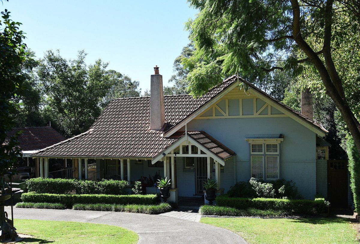
St Johns Avenue is a heritage conservation area. Most of it came from the 1912 St Johns Park Estate subdivision, whose covenants required houses of brick or stone. Residents paid for the street to be paved, and in 1928 they funded the brush box street trees that still line it. A 2022 heritage assessment describes the typical garden there as a mature shrub-based garden with some specimen plants, which matches what I'd expect of North Shore gardens from that time.
Gordon also has Eryldene, a house and garden on the State Heritage Register, famous for the camellia collection built up by Professor E. G. Waterhouse.
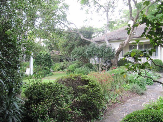
Camellias are part of Gordon's garden history, thanks largely to Eryldene. On the hard-setting Lucas Heights soil, camellias and azaleas do best with plenty of organic matter and mulch. My heritage and classic gardens guide covers the plants and layouts that suit these homes. If you're in a heritage conservation area, check the council rules guide before removing trees, hedges or garden walls.
1950s and later gardens
Gordon developed quickly in the 1950s, and more recently there's been higher-density housing around the town centre and station. Those blocks tend to have smaller gardens, more paving and often imported soil.
Bushland-edge gardens
The gullies that drain off the Gordon ridge still hold bushland, including the Flying Fox Reserve on Stony Creek. Gardens backing onto these creeks are on the sandstone side of the suburb. That's where local sandstone plants, careful weed control and keeping garden waste out of the bush matter most.
Working on your garden in Gordon
I work across Sydney's North Shore, including Gordon (see my Ku-ring-gai area page). Neighbouring suburbs in this series are Killara, Pymble, West Pymble, East Killara and St Ives.
Sources
- NSW DCCEEW, State Vegetation Type Map, pre-1750 Plant Community Types (map service VIS/SVTM_NSW_1750_PCT), queried 13 Oct 2026
- NSW Spatial Services, NSW Administrative Boundaries, Suburb layer (Gordon, 379 ha)
- BioNet Vegetation Classification, PCT definitions 3262, 3136, 3592 and 3176
- NSW Threatened Species profile, Sydney Turpentine-Ironbark Forest
- NSW Threatened Species profile, Blue Gum High Forest
- NSW DCCEEW, Soil Landscapes of the Sydney 1:100,000 Sheet (Chapman & Murphy 1989; map ed. 4, 2009), map service queried 13 Oct 2026
- NSW DCCEEW eSPADE, Lucas Heights (lh) soil landscape report, from Chapman & Murphy 1989
- NSW DCCEEW eSPADE, Glenorie (gn) soil landscape report, from Chapman & Murphy 1989
- NSW DCCEEW eSPADE, Gymea (gy) soil landscape report, from Chapman & Murphy 1989
- NSW DCCEEW eSPADE, Hawkesbury (ha) soil landscape report, from Chapman & Murphy 1989
- Ku-ring-gai Council, Biodiversity and Riparian Lands Study
- Edwards Z & Rowland J, Gordon, Dictionary of Sydney, 2008
- Hector Abrahams Architects, Heritage Assessment, 64 St Johns Avenue, Gordon (Ku-ring-gai Council meeting attachment, Oct 2022)
- Heritage NSW, Eryldene, State Heritage Register
- Eryldene Trust, The Eryldene camellia collection