
Killara is shale country. Almost half the suburb sits on heavy clay soil weathered from Wianamatta shale, and most of the rest is on the transitional soil just below it. That's why Killara's old gardens are so lush, and also why so many of them have drainage problems.
This guide is part of my series on North Shore suburbs. I've overlaid Killara's boundary on the NSW Government's soil and vegetation maps to see what the land was like before clearing, and how it was changed.
What grew in Killara before 1788
The state's modelled pre-clearing map shows Killara was almost three-quarters tall shale forest:
| Plant community | Share of the suburb |
|---|---|
| Blue Gum High Forest | about 37% |
| Sydney Turpentine Ironbark Forest | about 35% |
| Sydney Coastal Enriched Sandstone Forest | about 13% |
| Sydney Enriched Sandstone Moist Forest | about 11% |
| Sydney Coastal Sandstone Gully Forest | about 4% |
Blue Gum High Forest
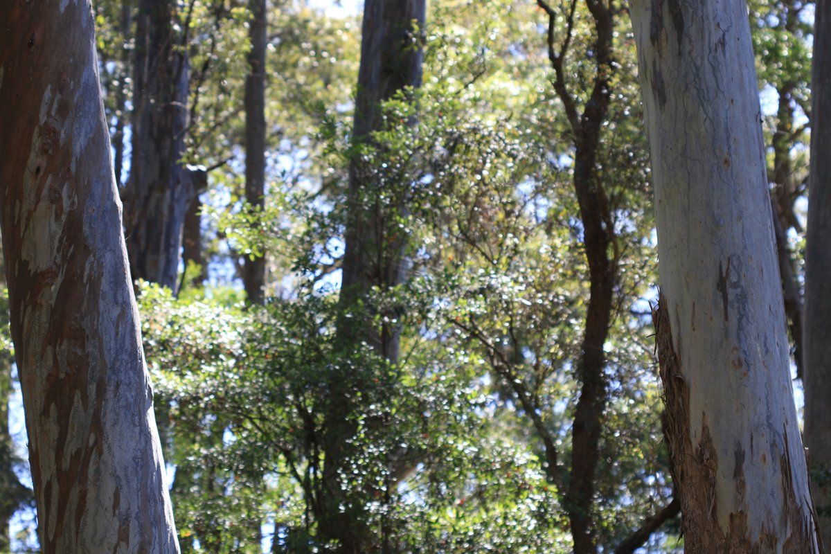
Blue Gum High Forest once ran along the ridges of Sydney's north from Crows Nest to Hornsby, and Killara was right in the middle of it. It's a very tall forest of Sydney blue gum (Eucalyptus saligna) with blackbutt (Eucalyptus pilularis) and sometimes turpentine. The understorey was soft and green rather than prickly: sweet pittosporum (Pittosporum undulatum), blueberry ash, hickory wattle (Acacia parramattensis), breynia, elderberry panax, and a ground cover of weeping grass, basket grass (Oplismenus aemulus), pastel flower (Pseuderanthemum variabile) and maidenhair fern.
It's critically endangered now. By 2000 there was less than 200 hectares left across Sydney, and the largest single remnant is under 20 hectares. If you have a very old blue gum or blackbutt in your garden, it may well be a remnant of this forest.
Sydney Turpentine-Ironbark Forest
On the slightly lower, shale-influenced ground the forest shifted to turpentine (Syncarpia glomulifera), with blackbutt, Sydney red gum and sometimes grey ironbark and stringybarks. It's also critically endangered.
The sandstone gullies
Where Killara's creeks have cut down into the sandstone, the map shows Sydney red gum, red bloodwood and Sydney peppermint on those slopes, moist fern-filled forest in the sheltered gullies, and in the rockiest gullies Sydney peppermint and red gum over NSW Christmas bush, old man banksia (Banksia serrata), sunshine wattle (Acacia terminalis) and other sandstone shrubs.
My which plant community guide can help you work out which of these your block sat in.
Killara soil type: heavy clay over shale
| Soil landscape | Share of the suburb | Rock underneath | What it's like |
|---|---|---|---|
| Glenorie | about 49% | Wianamatta shale | Red clay soils on crests, red-brown clays on upper slopes, deep yellow clays lower down, wet grey clays in drainage lines |
| Lucas Heights | about 32% | Mittagong Formation | Gentle ridges, hard-setting yellow clay soils, stony, low fertility, holds little water |
| Hawkesbury | about 10% | Hawkesbury Sandstone | Steep rocky gully sides, shallow patchy sand |
| Gymea | about 9% | Hawkesbury Sandstone | Gentler sandstone slopes, sandy, permeable, very low fertility |
What that means in the garden
Drainage is the big one. The Glenorie soils can have an impermeable, highly plastic clay subsoil. Water soaks into the topsoil, hits the clay and sits there. That's why lower parts of Killara gardens stay wet for days after rain, and why plants that need sharp drainage, such as waratahs, so often fail there. Along drainage lines the soil survey records gleyed soils, which form where the ground stays wet.
What helps:
- Plant into raised beds or mounds rather than digging deep holes into the clay.
- Choose plants that cope with heavy, occasionally wet soil for the low spots.
- Add organic matter to the top layer and keep it mulched.
- Avoid digging the clay when it's wet.
The clay is moderately reactive, which means it swells when wet and shrinks when dry. Keep that in mind when planning big plantings or watering systems close to the house, and talk to an engineer or arborist if you're worried about a tree near footings.
Erosion: the survey rates Glenorie soils as a high erosion hazard. Bare ground on a slope after demolition or landscaping can lose its topsoil quickly in a storm.
On the transitional soil (Lucas Heights): the surface sets hard, holds little water and is low in nutrients. Mulch and compost are the fix.
In the sandstone gullies: the opposite problem. It's free-draining, acidic and low in nutrients, and suits the local sandstone plants best.
The soil survey measured Glenorie topsoils at about pH 5.0 to 6.0 and the clay subsoil at about pH 4.0 to 5.5. That's acidic. I'd still test pH in a couple of spots before liming or feeding, as it can change across one block.
How the 1800s changed Killara's soil
Killara's name comes from an Aboriginal word meaning "always there". The first European industry was timber. Late in 1805 Governor King sent a convict gang to the North Shore to cut ship timber, and by 1809 at the latest the government's Lane Cove Sawing Establishment was running on the river flat at the bottom of what is now Fiddens Wharf Road, inside today's Killara boundary. By 1814 it had 48 convicts, including sawyers, fellers and shingle-splitters. The timber went down to the Lane Cove River and on to Sydney by boat. The camp closed in 1819 because the site had been stripped of suitable trees.
In April 1821 Governor Macquarie issued five land grants that shaped present-day Killara. The owners had to cultivate 20 acres within five years. Their land was logged first, mostly for blackbutt, ironbark, stringybark and blue gum, then cleared for farming. The biggest grant, Springdale, came in 1839, 160 acres around today's station.
Killara station opened on 10 July 1899. Local schoolteacher J. G. Edwards then subdivided the Springdale land and promoted Killara as a garden suburb, free of shops. Blocks were large, often more than an acre, and by 1923 there were about 500 houses.
What that meant for the soil:
- The convict camp and early logging removed the tall forest that had protected the clay soils for thousands of years.
- Compulsory cultivation under the grant conditions meant ploughed clay ground on slopes, on a soil with a high erosion hazard.
- The garden suburb period brought large houses on large blocks, with new driveways, drains, tennis courts and gardens built over what had been farm and forest.
Underneath, it's still Glenorie clay. Any digging for new houses, pools or extensions can bring that subsoil to the surface, so check what's under a new garden bed before you plant.
Killara gardens today
The garden suburb
Edwards' large blocks mean Killara still has many big, established gardens, often under tall eucalypts. The classic style here is the Federation and inter-war garden: lawn, clipped hedges, flowering shrubs and a few large trees.

Heritage conservation areas
Several parts of Killara are heritage conservation areas under Ku-ring-gai's planning rules. One example is the Marian Street conservation area, bounded by Culworth Avenue, Lorne Avenue, the Pacific Highway and Marian Street. Its heritage value comes from the Springdale Estate subdivision and its high proportion of good-quality late 19th century, Federation and inter-war houses. My heritage and classic gardens guide covers the planting and layouts that suit these homes, and the council rules guide links to what needs approval.
Blue gum remnants in gardens
The Blue Gum High Forest listing names some of the threats to remnants: weeds such as privet and ochna, and the loss of understorey to landscaping and continual mowing. If you have big blue gums or blackbutts in your garden, letting a patch under them grow back with local shrubs and grasses, instead of lawn, is one of the most useful things you can do.
Modern gardens
Newer Killara homes tend to have more paving, pools and clipped, low-maintenance planting. On this soil, getting the drainage right at the start saves a lot of trouble later.
Working on your garden in Killara
I work across Sydney's North Shore, including Killara (see my Ku-ring-gai area page). Neighbouring suburbs in this series are Gordon, Lindfield, East Killara and West Pymble. If you're thinking about waratahs on clay, read why waratahs die in Sydney gardens first.
Sources
- NSW DCCEEW, State Vegetation Type Map, pre-1750 Plant Community Types (map service VIS/SVTM_NSW_1750_PCT), queried 13 Oct 2026
- NSW Spatial Services, NSW Administrative Boundaries, Suburb layer (Killara, 464 ha)
- BioNet Vegetation Classification, PCT definitions 3136, 3262, 3592, 3176 and 3595
- NSW Threatened Species profile, Blue Gum High Forest
- NSW Threatened Species profile, Sydney Turpentine-Ironbark Forest
- NSW DCCEEW, Soil Landscapes of the Sydney 1:100,000 Sheet (Chapman & Murphy 1989; map ed. 4, 2009), map service queried 13 Oct 2026
- NSW DCCEEW eSPADE, Glenorie (gn) soil landscape report, from Chapman & Murphy 1989
- NSW DCCEEW eSPADE, Lucas Heights (lh) soil landscape report, from Chapman & Murphy 1989
- NSW DCCEEW eSPADE, Hawkesbury (ha) soil landscape report, from Chapman & Murphy 1989
- NSW DCCEEW eSPADE, Gymea (gy) soil landscape report, from Chapman & Murphy 1989
- Ku-ring-gai Council, Biodiversity and Riparian Lands Study
- Dictionary of Sydney, Lane Cove Sawing Establishment (place record)
- Dictionary of Sydney, West Lindfield
- STEP Inc, Timbergetting in the Lane Cove Catchment
- Edwards Z, Killara, Dictionary of Sydney
- Curio Projects (attachment to Ku-ring-gai Council meeting 27 June 2017), Heritage Impact Statement, 21 Lorne Avenue Killara