
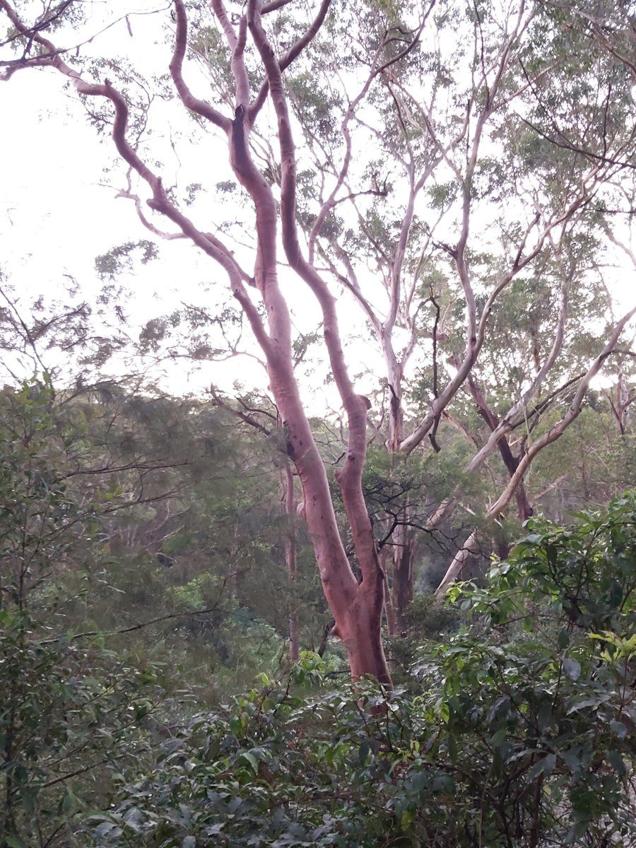
Lindfield runs from the shale ridge along the Pacific Highway and the railway down through West Lindfield to the Lane Cove River. So it has a bit of everything, from heavy clay on the ridge to steep sandstone in the valleys and even a strip of river flat. Where your garden sits on that slope decides most of what will grow well in it.
This guide is part of my series on North Shore suburbs. I've overlaid the Lindfield boundary on the NSW Government's soil and vegetation maps to see what was here before clearing and how the land has changed.
What grew in Lindfield before 1788
| Plant community | Share of the suburb |
|---|---|
| Sydney Turpentine Ironbark Forest | about 34% |
| Sydney Coastal Enriched Sandstone Forest | about 18% |
| Blue Gum High Forest | about 18% |
| Sydney Enriched Sandstone Moist Forest | about 13% |
| Sydney Coastal Sandstone Gully Forest | about 13% |
| Sydney Coastal Shale-Sandstone Forest | about 2% |
| Estuarine Swamp Oak Twig-rush Forest | about 1% |
On the ridge: turpentine and blue gum
The ridge and its upper slopes carried Sydney Turpentine-Ironbark Forest, with turpentine (Syncarpia glomulifera) in almost every patch, plus blackbutt, Sydney red gum, grey gum and sometimes grey ironbark, over a grassy ground layer. On the richest, wettest shale it became Blue Gum High Forest, dominated by Sydney blue gum (Eucalyptus saligna). Both are now critically endangered.
On the slopes: Sydney red gum country
More than 40% of Lindfield was sandstone forest of one kind or another, more than in Gordon or Killara. Just below the shale, where some clay has washed down onto the sandstone, the map shows forest of Sydney red gum (Angophora costata) with red bloodwood and Sydney peppermint. Under them grew sweet pittosporum and she-oaks (Allocasuarina), over shrubs such as slender tea-tree, broad-leaf geebung, crinkle bush, prickly Moses (Acacia ulicifolia) and hop bush (Dodonaea triquetra), and a ground layer of blue flax lily (Dianella caerulea) and spiny-headed mat-rush.
On rockier slopes this turned into the heathier sandstone gully forest of Sydney peppermint and red gum over NSW Christmas bush and old man banksia, and in the most sheltered gullies into tall, ferny moist forest.
Down at the water
The map shows a small area of estuarine swamp oak forest beside the Lane Cove River in the south-west of the suburb.
To work out which community your block belonged to, try my which plant community guide.
Lindfield soil type: ridge, slope and river flat
| Soil landscape | Share of the suburb | Rock underneath | What it's like |
|---|---|---|---|
| Glenorie | about 36% | Wianamatta shale | Red and yellow clays, heavy, sometimes impermeable subsoil, high erosion hazard |
| Lucas Heights | about 29% | Mittagong Formation | Gentle ridges, hard-setting yellow clays, stony, low fertility, holds little water |
| Hawkesbury | about 24% | Hawkesbury Sandstone | Steep rocky slopes, shallow patchy sand, extremely erodible, low fertility |
| Lane Cove | about 5% | River sediment | Alluvial soils on the river flats |
| Gymea | about 5% | Hawkesbury Sandstone | Gentler sandstone slopes, sandy, permeable, very low fertility |
What that means in the garden
Near the highway and railway (Glenorie): heavy clay with drainage problems in places. Build up beds for plants that need good drainage, mulch to protect the surface, and keep slopes planted.
The middle slopes (Lucas Heights): the soil sets hard and sheds water. Organic matter and mulch are what make the difference.
The steeper blocks running down to the river and creeks (Hawkesbury): shallow sand over rock, very free-draining, strongly acidic and very low in nitrogen and phosphorus. The soil survey rates this landscape as extremely erodible, so any bare slope, especially after building work, can wash away fast in a storm. Deeper, better soil tends to collect in sheltered gullies and against rock ledges.
On the river flats (Lane Cove alluvial): a small area beside the Lane Cove River, mapped as alluvial soil, which means it was built from sediment laid down by the river. If you're on one of these blocks, treat it as its own case and test it.
On a sloping Lindfield block you can easily be on two soil landscapes at once, clay at the top and sand at the bottom. I'd check both ends before planning any planting.
How the 1800s changed Lindfield's soil
The first Europeans to work the district were timber-getters. In 1805 the botanist George Caley reported fine timber in the upper Lane Cove valley, and late that year Governor King ordered a convict gang to the North Shore to cut ship timber. The government's camp, the Lane Cove Sawing Establishment, was running on the river flat at Fidden's Wharf, just over today's border in Killara, sometime between 1805 and 1809, and it was disbanded by October 1819. When Governor Macquarie visited in May 1810, he found the timber between Hornsby and Roseville was already getting scarce. Logs and sawn timber from the ridges went down the track that became Fiddens Wharf Road and then by boat to Sydney. The first land grant came in 1815, mostly near the river, which was the main way to move goods.
Once the valuable timber had gone, orchards and farms took over, and from the 1840s fruit growing and farming were the main industries. When the railway arrived in 1890, growers could get soft fruit to market, and they changed their plantings. Land along the line rose in value and suburban subdivision began. Tom Coleman's dairy, on what is now the library site, supplied milk to the new residents, and many households kept a cow or two.
What that meant for the soil:
- Logging took the biggest trees first. Between 1810 and the late 1830s, government and unlicensed timber-getters felled the largest trees in the district and set up sawpits along the ridgeline from Roseville to Wahroonga and above Fidden's Wharf on the Lane Cove River.
- Orchards and farms from the 1840s meant 50 years of cultivated ground before the suburb arrived. On slopes rated as high or extreme erosion hazard, that's a long time for topsoil to wash downhill.
- Railway subdivision after 1890 turned paddocks and orchards into house blocks.
Lindfield gardens today
Federation and inter-war gardens
Lindfield grew as a railway suburb after 1890, and by the early 20th century it had a post office, shops, churches, schools and tennis clubs. Its oldest suburban houses and gardens date from that Federation era and the inter-war years that followed.
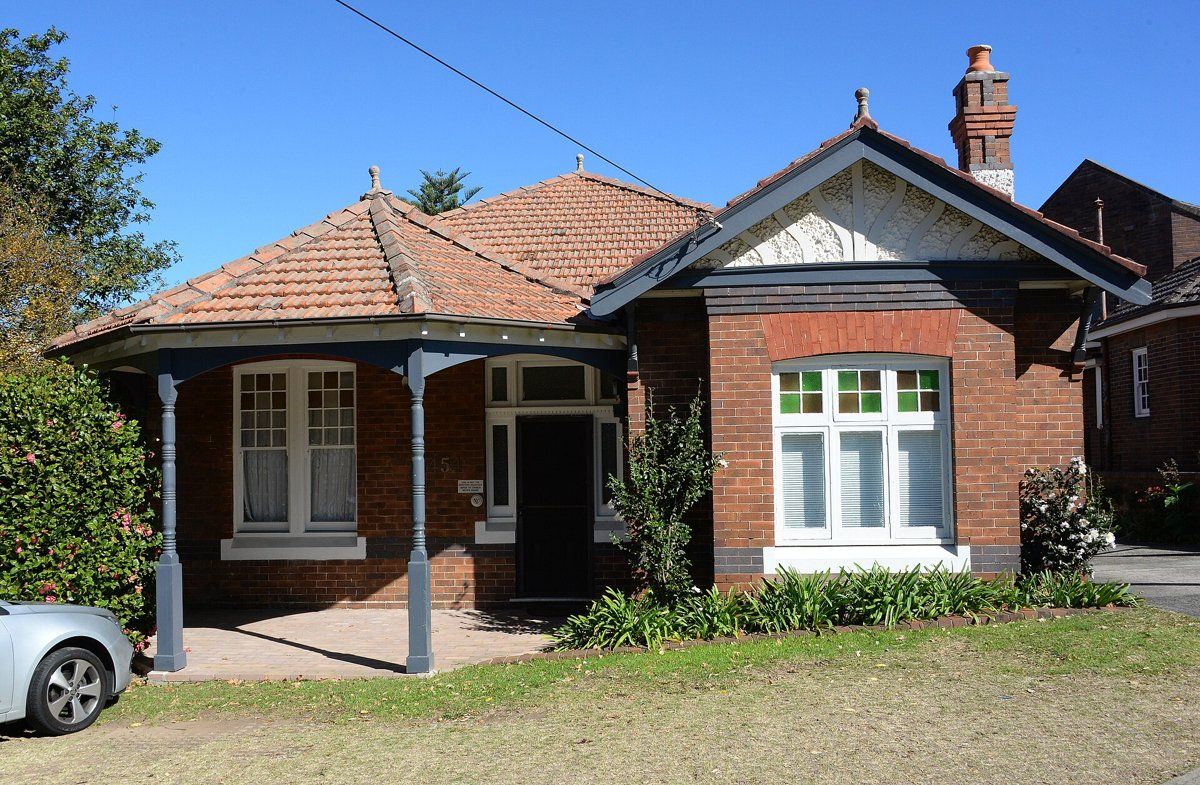
Lindfield has heritage conservation areas under Ku-ring-gai's planning rules. One of the more recent is the Middle Harbour Road, Lindfield, Conservation Area. When council assessed it, it looked at the gardens and street verges as well as the houses, which is a good reminder that in these areas the garden is part of what's being protected. My heritage and classic gardens guide covers planting for these homes, and the council rules guide explains what needs approval.
Camellias, azaleas and Swain Gardens
Swain Gardens in Lindfield, now looked after by the council, is a shady garden of camellias, magnolias, Japanese maples and rhododendrons. It's worth a visit to see what grows well in a sheltered, shady Lindfield garden. If you grow the same plants on the heavy clay near the ridge, give them good drainage and plenty of organic matter.
Bushland-edge gardens
West Lindfield runs down towards the Lane Cove River, and next door, East Lindfield is ringed by bushland around Gordon Creek, Middle Harbour and Moores Creek. Gardens on these bush edges are mostly on sandstone, and they're where local sandstone plants, good weed control and keeping garden waste out of the bush matter most.
Working on your garden in Lindfield
I work across Sydney's North Shore, including Lindfield (see my Ku-ring-gai area page). Neighbouring suburbs in this series are East Lindfield, Roseville, Killara and East Killara.
Sources
- NSW DCCEEW, State Vegetation Type Map, pre-1750 Plant Community Types (map service VIS/SVTM_NSW_1750_PCT), queried 13 Oct 2026
- NSW Spatial Services, NSW Administrative Boundaries, Suburb layer (Lindfield, 519 ha)
- BioNet Vegetation Classification, PCT definitions 3262, 3592, 3136, 3176, 3595 and 3259
- NSW Threatened Species profile, Sydney Turpentine-Ironbark Forest
- NSW Threatened Species profile, Blue Gum High Forest
- NSW DCCEEW, Soil Landscapes of the Sydney 1:100,000 Sheet (Chapman & Murphy 1989; map ed. 4, 2009), map service queried 13 Oct 2026
- NSW DCCEEW eSPADE, Glenorie (gn) soil landscape report, from Chapman & Murphy 1989
- NSW DCCEEW eSPADE, Lucas Heights (lh) soil landscape report, from Chapman & Murphy 1989
- NSW DCCEEW eSPADE, Hawkesbury (ha) soil landscape report, from Chapman & Murphy 1989
- NSW DCCEEW eSPADE, Lane Cove (lc) soil landscape report, from Chapman & Murphy 1989
- NSW DCCEEW eSPADE, Gymea (gy) soil landscape report, from Chapman & Murphy 1989
- Ku-ring-gai Council, Biodiversity and Riparian Lands Study
- Edwards Z & Rowland J, Lindfield, Dictionary of Sydney, 2012
- Dictionary of Sydney, Lane Cove Sawing Establishment (place record)
- Dictionary of Sydney, West Lindfield
- STEP Inc, Timbergetting in the Lane Cove Catchment
- Cameron-Smith B, West Pymble, Dictionary of Sydney, 2012
- Edwards Z, Killara, Dictionary of Sydney
- NSW Department of Planning and Environment, Plan Finalisation Report, Ku-ring-gai LEP 2015 Amendment No. 16