
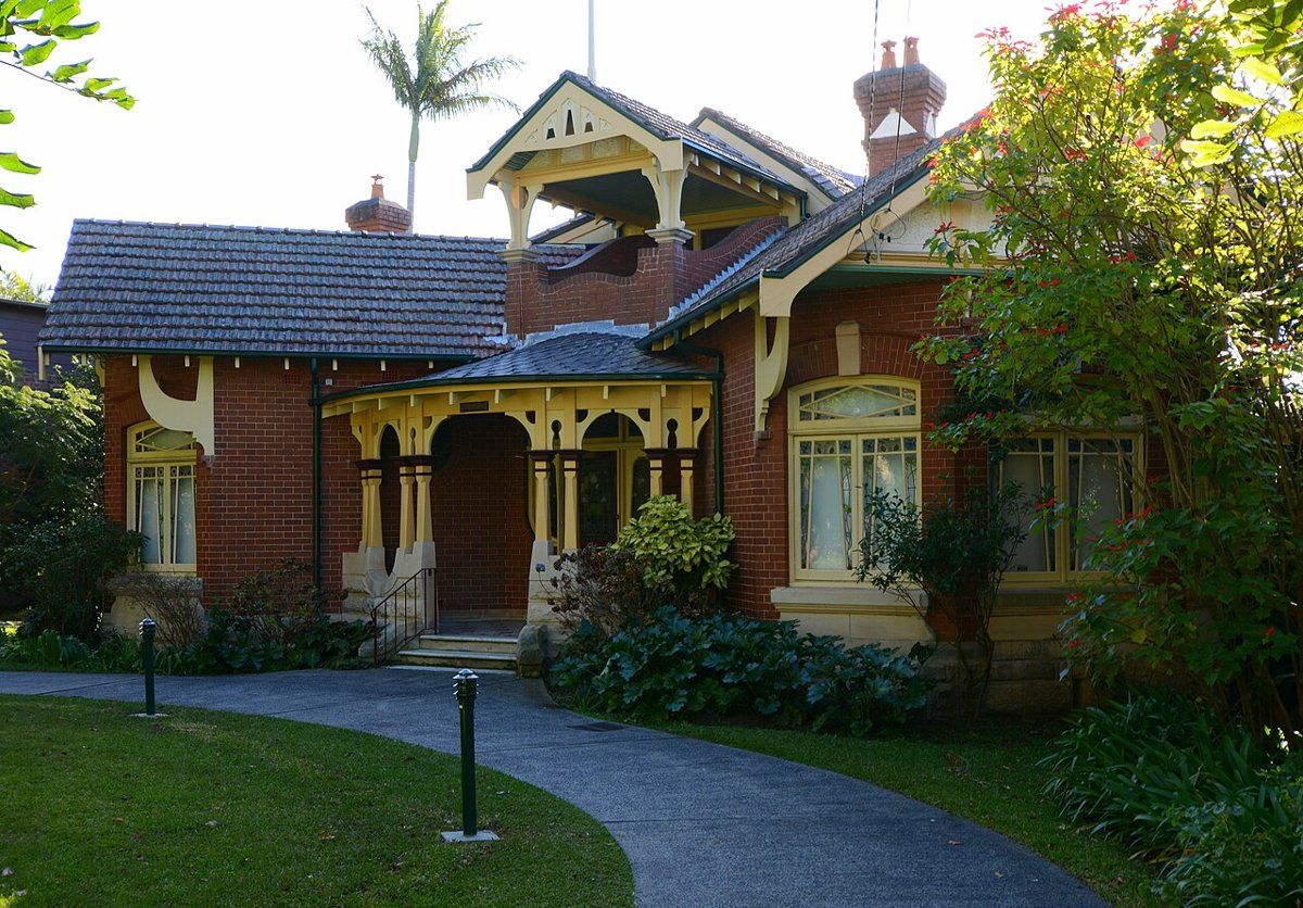
Roseville is the southernmost suburb of Ku-ring-gai, although by my overlay of the council boundaries about 88 of its 387 hectares, along the southern edge, are in Willoughby. It's mostly a clay suburb. Nearly half of it sits on shale clay, with the clay-influenced Lucas Heights soils over another quarter and sandstone coming in on the slopes down to the creeks. That shale is why Roseville grew blue gum forest, and it's also why so many Roseville gardens have heavy, slow-draining soil.
This guide is part of my series on North Shore suburbs. I've overlaid the Roseville suburb boundary on the NSW Government's soil and vegetation maps to see what was here before clearing and how the land was changed.
What grew in Roseville before 1788
| Plant community | Share of the suburb |
|---|---|
| Blue Gum High Forest | about 51% |
| Sydney Turpentine Ironbark Forest | about 28% |
| Sydney Coastal Enriched Sandstone Forest | about 9.5% |
| Sydney Enriched Sandstone Moist Forest | about 6.5% |
| Sydney Coastal Sandstone Gully Forest | about 3.5% |
Blue gum on the ridge
Half of Roseville was Blue Gum High Forest. On the deep shale soils along the ridge, Sydney blue gum (Eucalyptus saligna) and blackbutt (Eucalyptus pilularis) grew over a layer of smaller trees and soft shrubs. The NSW Government estimates about 99% of this community has been cleared across its range, and it's listed as critically endangered in NSW and nationally.
Turpentine-ironbark on the edges
Around the blue gum was Sydney Turpentine-Ironbark Forest, which BioNet describes on shale or sheltered shale-sandstone soils: turpentine (Syncarpia glomulifera) very frequently in the canopy, sometimes with blackbutt or Sydney red gum and occasionally ironbark, over a grassy ground layer. It's critically endangered too.
Sandstone on the creek slopes
The slopes down to Moores Creek and the other gullies were sandstone forest. Just below the shale, where clay has washed down, the map shows Sydney red gum (Angophora costata), red bloodwood and Sydney peppermint. In the sheltered gullies it turned into tall, moist, ferny forest.
To work out which community your block belonged to, try my which plant community guide.
Roseville soil type: mostly shale clay
| Soil landscape | Share of the suburb | Rock underneath | What it's like |
|---|---|---|---|
| Glenorie | about 47% | Wianamatta shale | Friable topsoil over red and yellow clay. Acidic, moderately reactive, waterlogs in places |
| Lucas Heights | about 28.5% | Mittagong Formation | Hard-setting yellow clay soils, stony, low fertility, holds little water |
| Gymea | about 21.5% | Hawkesbury Sandstone | Sandy soils with rock benches, permeable, very low fertility |
| Hawkesbury | about 3% | Hawkesbury Sandstone | Steep, rocky, shallow sand, extreme erosion hazard |
What that means in the garden
On the ridge (Glenorie): the survey describes a friable dark brown loam topsoil, up to about 15 cm deep on the crests, over reddish-brown clay. It measured the topsoil at about pH 5.0 to 6.0 and the clay at pH 4.0 to 5.5, and it notes that the topsoil can set hard once it's compacted. Lower down the slopes and along drainage lines the soils turn yellow and grey and can stay wet. If water sits in your planting holes after rain, that's why. Build beds up rather than digging down, and keep foot traffic and machinery off wet clay.
On the middle slopes (Lucas Heights): stony, hard-setting soils that hold little water. Mulch and organic matter matter more here than fertiliser.
On the sandstone (Gymea): sandy, free-draining and very low in nitrogen and phosphorus. Local sandstone plants are made for it. Hungry exotics need regular feeding.
How the 1800s changed Roseville's soil
Aboriginal people lived here for thousands of years before Europeans arrived. According to the Dictionary of Sydney, one of the first European settlers was William Henry, who began farming on land beside the Lane Cove River in 1814. Michael Fitzgerald received the first land grant in 1821.
The big change came with Clanville. In 1819 Daniel Dering Mathew took up a 400-acre grant, and in 1830 he sold it to Richard Archbold, who cleared it and planted orchards, using convict labour. The family kept the orchards going until 1850. Fruit went down Dick's Road, now Grosvenor Road, to the Lane Cove River and on to Sydney by boat. Archbold's cottage, Roseville, gave the suburb its name. Henry's land stayed as farmland until the 1890s, when two Chinese market gardeners, Why Tiy and Kwong Shing, took over the lease and ran large market gardens there into the 1900s.
Roseville station opened in 1890. The Archbold estate was cut up into house blocks, and estates followed with names like Dividend Estate (1893), Park View Estate (1910 to 1915) and Hilltop Estate (1915 to 1920).
What that meant for the soil:
- Clearing the forest for orchards and farms took off the cover that held the shale soils together. The soil survey rates Glenorie soils as a high erosion hazard once they're bare.
- Decades of orchards and market gardens meant cultivated ground for much of the 1800s, especially on Archbold's land and Henry's farm.
- Subdivision after 1890 turned those paddocks and orchards into house blocks.
If the top of your soil is pale, thin or hard, building it back up with organic matter is usually the best fix.
Roseville gardens today
Federation and inter-war gardens
Roseville has a lot of protected heritage for its size. The council lists six heritage conservation areas in Roseville: Archbold Farms, Earl of Carnarvon, Garden of Roseville Estate, Lord Street Bancroft Avenue, Shirley Road and The Grove. A seventh, Clanville, crosses into Lindfield. The council notes that fences, trees and gardens all contribute to what makes these areas significant, so the garden is part of the heritage, not just the house.
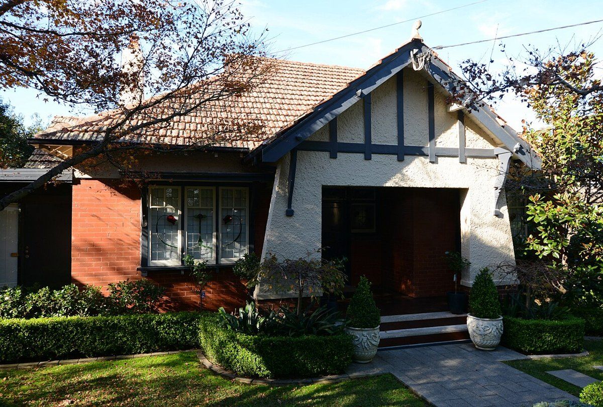
My heritage and classic gardens guide covers planting for these houses, and the council rules guide explains what needs approval in a conservation area.
Clay-soil gardens
The soil survey notes that tall trees are common on the Glenorie landscape, and the clay on the ridge is deep, but drainage decides what survives in the beds. On many Roseville blocks the most useful work is lifting and improving the soil before planting anything new.
Gardens near the creeks
Blocks that drop towards Moores Creek and the other gullies move onto sandstone. These gardens suit local sandstone plants, and they're the ones where keeping garden waste and weeds out of the bush matters most.
Working on your garden in Roseville
I work across Sydney's North Shore, including both the Ku-ring-gai and Willoughby sides of Roseville. Nearby suburbs in this series are Lindfield, East Lindfield and Killara.
Sources
- NSW DCCEEW, State Vegetation Type Map, pre-1750 Plant Community Types (map service VIS/SVTM_NSW_1750_PCT), queried 13 Oct 2026
- NSW Spatial Services, NSW Administrative Boundaries, Suburb layer (Roseville, 387 ha) and Local Government Area layer (overlay: about 299 ha in Ku-ring-gai, about 88 ha in Willoughby)
- BioNet Vegetation Classification, PCT definitions 3136, 3262, 3592 and 3176
- NSW Threatened Species profile, Blue Gum High Forest in the Sydney Basin Bioregion
- NSW Threatened Species profile, Sydney Turpentine-Ironbark Forest in the Sydney Basin Bioregion
- NSW DCCEEW, Soil Landscapes of the Sydney 1:100,000 Sheet (Chapman & Murphy 1989; map ed. 4, 2009), map service Soil_Landscape/Sydney queried 13 Oct 2026
- NSW DCCEEW eSPADE, Glenorie (gn) soil landscape report, from Chapman & Murphy 1989
- NSW DCCEEW eSPADE, Lucas Heights (lh) soil landscape report, from Chapman & Murphy 1989
- NSW DCCEEW eSPADE, Gymea (gy) soil landscape report, from Chapman & Murphy 1989
- Edwards Z, Roseville, Dictionary of Sydney, 2008
- "Ku-ring-gai Council, Heritage conservation areas (list of HCAs by suburb, history of the listings, and note that fences, trees and gardens contribute to significance), read 13 Oct 2026