

Hornsby is one of the most mixed suburbs on the upper North Shore when it comes to soil. In the space of a few streets you can go from heavy shale clay on the ridge, to thin sand over sandstone on the slopes, to rich volcanic soil in Old Mans Valley. That mix explains a lot about why one garden in Hornsby grows camellias and lawn with no effort while the next one, a block downhill, struggles to keep anything alive.
This is the first in a series of suburb guides. For each suburb I've gone back to the state government's soil and vegetation maps, overlaid the suburb boundary, and worked out what the ground was like before it was cleared, what happened to it in the 1800s, and what that means for the garden you have now.
What grew in Hornsby before 1788
The NSW Government has a modelled map of the plant communities that grew across the state before clearing. Inside Hornsby's suburb boundary, it shows roughly this:
| Plant community | Share of the suburb | Where it grew |
|---|---|---|
| Blue Gum High Forest | about 30% | Shale ridges and the volcanic soils |
| Sydney Enriched Sandstone Moist Forest | about 18% | Sheltered gullies below the shale |
| Sydney Hinterland Turpentine-Apple Gully Forest | about 15% | Steep sheltered sandstone slopes |
| Sydney Coastal Sandstone Bloodwood Shrub Forest | about 13% | Exposed sandstone crests |
| Sydney Turpentine Ironbark Forest | about 9% | Shale-influenced slopes |
| Sydney Coastal Enriched Sandstone Forest | about 9% | Slopes just below the shale |
| Northern Sydney Scribbly Gum Woodland | about 4% | Sandstone ridgetops |
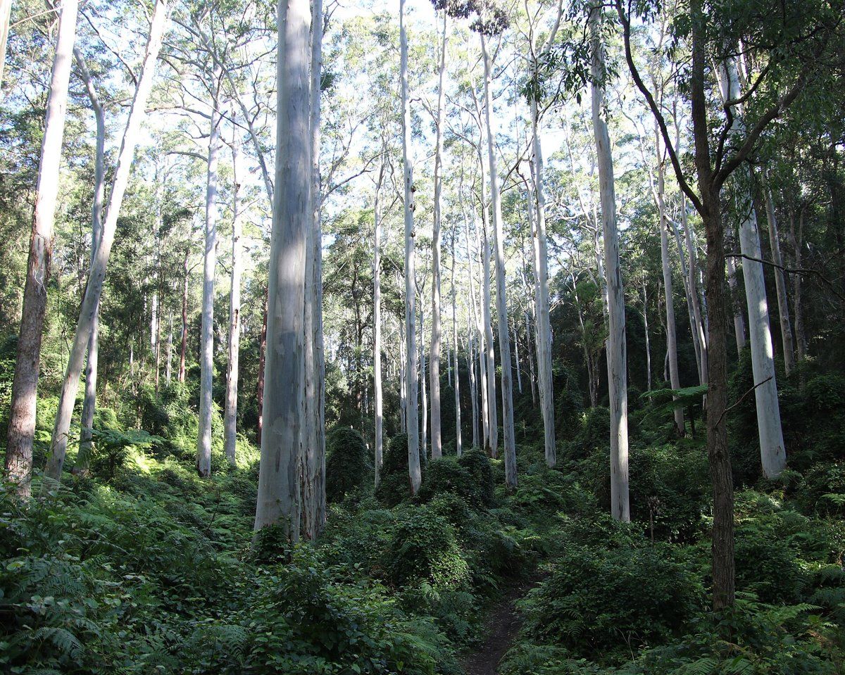
Blue Gum High Forest
This was the big one. It's a very tall forest of Sydney blue gum (Eucalyptus saligna), often with blackbutt (Eucalyptus pilularis) and sometimes turpentine (Syncarpia glomulifera). Underneath were small trees like sweet pittosporum (Pittosporum undulatum) and blueberry ash (Elaeocarpus reticulatus), shrubs such as breynia (Breynia oblongifolia) and elderberry panax (Polyscias sambucifolia), and a soft ground layer of weeping grass (Microlaena stipoides), maidenhair fern and native vines like wonga vine (Pandorea pandorana).
It only grows where rainfall is above about 1100 mm a year and the soil is the richer kind that comes from shale. It also grows on soils from the old volcanic pipes (diatremes), which Hornsby has. Today it's listed as critically endangered in NSW and nationally. By 2000 there was less than 200 hectares of it left, about 4.5% of what there once was.
Sydney Turpentine-Ironbark Forest
On the shale-influenced slopes, turpentine was the signature tree, with grey ironbark (Eucalyptus paniculata), grey gum (Eucalyptus punctata) and stringybarks. It had a grassy, herby ground layer with kangaroo grass (Themeda triandra) and spiny-headed mat-rush (Lomandra longifolia). It's also critically endangered.
The sandstone forests
Below the shale, the forests changed completely. The sheltered gullies had tall Sydney red gum (Angophora costata), turpentine and blackbutt over a carpet of ferns such as rainbow fern (Calochlaena dubia) and bracken. The steeper sandstone slopes carried red gum, turpentine and Sydney peppermint (Eucalyptus piperita), with NSW Christmas bush (Ceratopetalum gummiferum), geebungs and grass trees. Up on the exposed sandstone crests it was red bloodwood (Corymbia gummifera) over a dense, flowery heath of banksias, mountain devil (Lambertia formosa), tea-trees, hakeas and grevilleas, and on the driest ridgetops, scribbly gum (Eucalyptus haemastoma).
If you want to work out which of these your own block sat in, my which plant community guide walks you through it.
Hornsby soil type: shale, sandstone and an old volcano
The parent rock
Hornsby sits on the Hornsby Plateau. The ridge that the Pacific Highway and the railway follow is capped with Wianamatta Group shale (Ashfield Shale). Under that sits the Mittagong Formation, thin bands of shale and fine sandstone. Under everything is Hawkesbury Sandstone, which shows up wherever the creeks have cut down into it.
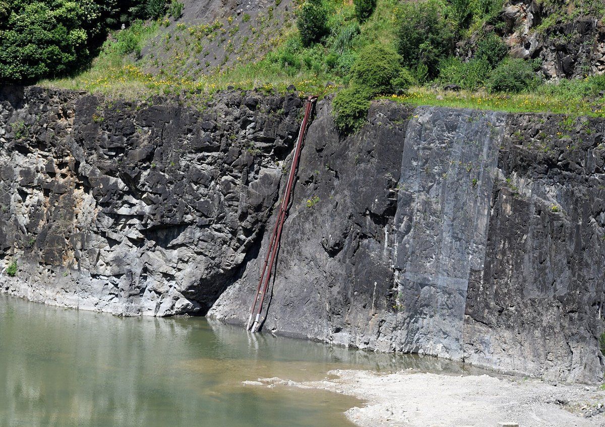
Then there's the odd one out. Old Mans Valley, now Hornsby Valley, is the site of ancient volcanic diatremes, pipes of volcanic rock that punched up through the sandstone. It was quarried for more than 100 years for road base and gravel.

The soil landscapes
The NSW soil landscape map (the same data you can browse in eSPADE) splits Hornsby up like this:
| Soil landscape | Share of the suburb | Rock underneath | What it's like |
|---|---|---|---|
| Hawkesbury | about 37% | Hawkesbury Sandstone | Steep, rocky, shallow patchy sand. Very erodible, drains fast, low fertility |
| Glenorie | about 24% | Wianamatta shale | Red clay soils on the crests, yellow clays lower down. Heavy, sometimes impermeable, plastic subsoil, high erosion hazard |
| Lucas Heights | about 21% | Mittagong Formation | Gentle ridges, hard-setting yellow clay soils, stony, low fertility, holds little water |
| Gymea | about 7% | Hawkesbury Sandstone | Gentler sandstone slopes, sandy yellow earths, permeable, very low fertility |
| Hornsby | about 5% | Volcanic diatremes | Deep clay soils on weathered volcanic rock, low to moderate fertility, highly reactive subsoil |
| Disturbed terrain | about 3% | Varies | Ground reshaped by quarrying, cutting and filling |
What that means in the garden
On the shale (Glenorie): this is the best soil in Hornsby for growing most things, but drainage is the catch. The subsoil can be heavy, plastic clay that water barely moves through, so planting holes fill up like a bucket after rain. Raise beds or mound plants that hate wet feet, and don't dig a deep hole and fill it with potting mix. The soil survey measured the topsoil here at about pH 5.0 to 6.0 and the clay underneath at about pH 4.0 to 5.5, so it's acidic all the way down. The soil survey also rates it as a high erosion hazard, so don't leave slopes bare.
On the Mittagong soils (Lucas Heights): the surface sets hard when it dries and the soil holds little water. Mulch and organic matter make the biggest difference here.
On the sandstone (Hawkesbury and Gymea): water runs straight through, and these soils are naturally strongly acidic and very low in nitrogen and phosphorus. That suits the local sandstone natives, which evolved for it, but exotics like roses and vegetables will need a lot of feeding. Soil depth varies a lot: it's often less than 70 cm, but along cracks in the rock it can go down more than two metres.
In Old Mans Valley (Hornsby soil landscape): deep clay soils formed on weathered volcanic rock. They're unusual for Sydney, and the survey also records rich red krasnozems and chocolate soils mixed in. Blue Gum High Forest grew on them. The catch is that the subsoil is highly plastic and highly reactive, so it swells and shrinks a lot with wet and dry spells.
Soil pH varies even within one block, so I'd always test before adding lime or sulphur rather than going by the map.
How the 1800s changed Hornsby's soil
The Dharug people lived across this country long before Europeans arrived. After settlement, the first industry around Hornsby was timber getting. The cutters went for the blue gums and ironbarks along the ridges, which is exactly the Blue Gum High Forest and Turpentine-Ironbark country on the best shale soil.
Thomas Edward Higgins, granted land in Old Mans Valley in 1824, settled in 1832 and started selling timber from the valley in 1835. He also farmed the rich alluvial soils and planted orchards on the valley slopes. In 1838 there were only four houses in the parish. The settlement on the ridge was known as Jack's Island, an island of settlement in the bush.
The railway changed everything. Hornsby station opened at Jack's Island on 17 September 1886, and in 1890 the North Shore line from St Leonards joined it, making Hornsby a junction. Land values soared and families of city businessmen moved in. The population went from 423 in 1891 to 1,818 in 1901. A blue metal and gravel quarry began in Old Mans Valley around 1906.
What that meant for the soil:
- Clearing the ridges took off the forest that held the shale soils together. On a soil the survey rates as a high erosion hazard, bare ground loses topsoil fast.
- Orchards and farming on slopes meant years of cultivated ground on hillsides, which is when topsoil washes off.
- Subdivision after the railway brought house sites, roads and drainage. Cutting and filling to level blocks can leave clay subsoil or rubble at the surface where you'd expect topsoil.
- Quarrying reshaped part of the valley completely. The soil map shows that ground as disturbed terrain.
If your garden has a thin, hard, pale layer on top, or patches where nothing grows well, it may be fill or exposed subsoil rather than the soil that formed there naturally. Building the topsoil back up with organic matter, mulch and the right plants is usually more effective than trying to fix it with fertiliser.
Hornsby gardens today
Federation and inter-war heritage gardens
In the Federation period, the Mount Errington area on the western side of Hornsby was the top end of town, with grand houses set in big gardens. Mount Errington itself, the house that gave the area its name, was built in the Arts and Crafts style in 1898 and 1899, and the name was used for the subdivision from 1913. Many large blocks have since been subdivided, but enough survives for it to be a heritage precinct.
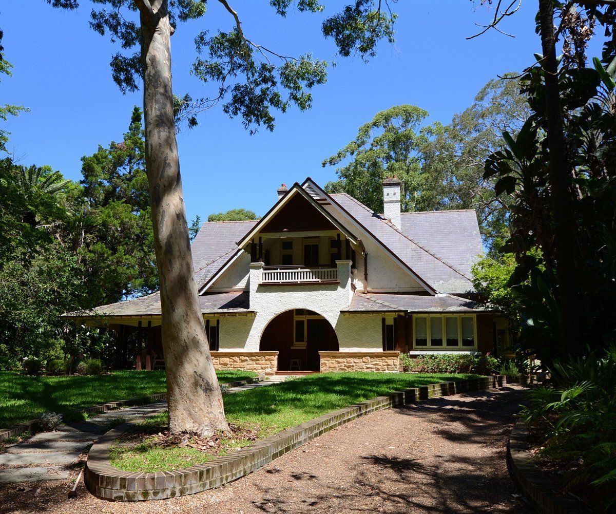
Hornsby has two of the shire's six heritage conservation areas: Hornsby West Side, which includes the Mount Errington precinct, and Barker College. If your home is in one, external works generally need council approval, although day-to-day gardening and minor maintenance usually don't. My heritage and classic gardens guide covers the plants and layouts that suit these houses, and the council rules guide links to Hornsby's tree and heritage controls.
Bushland-edge gardens
A lot of Hornsby backs onto bushland in the sandstone gullies, including Old Mans Valley and the Berowra Valley bushland. On these blocks the garden is part of the bush edge. Local sandstone plants are the right choice here, garden escapes are a real problem, and stormwater from roofs and paving can carry nutrients and weeds straight downhill into the bush.
Postwar, modern and apartment gardens
Hornsby grew steadily after World War II, and since 2014 the planning rules for the West Side precinct near the station have allowed buildings of 8 to 25 storeys. More and more Hornsby gardens are small courtyards, balconies and the planting strips around unit blocks, often on fill or over concrete.
Working on your garden in Hornsby
If you know whether you're on shale, sandstone or the volcanic soils, you can choose plants that suit the site rather than fight it. I work across Sydney's North Shore, including Hornsby, and the same approach applies in the rest of this series. The closest guides are the neighbouring suburbs of Wahroonga and North Wahroonga, and the series also covers Ku-ring-gai suburbs like Turramurra, Gordon and St Ives. For one plant that shows the shale and sandstone difference clearly, see why waratahs die in Sydney gardens.
Sources
- NSW DCCEEW, State Vegetation Type Map, pre-1750 Plant Community Types (map service VIS/SVTM_NSW_1750_PCT), queried 13 Oct 2026
- NSW Spatial Services, NSW Administrative Boundaries, Suburb layer (Hornsby, 847 ha)
- BioNet Vegetation Classification, PCT definitions 3136 Blue Gum High Forest, 3262 Sydney Turpentine Ironbark Forest, 3176 Sydney Enriched Sandstone Moist Forest, 3621 Sydney Hinterland Turpentine-Apple Gully Forest, 3593 Sydney Coastal Sandstone Bloodwood Shrub Forest, 3592 Sydney Coastal Enriched Sandstone Forest, 3586 Northern Sydney Scribbly Gum Woodland
- NSW Threatened Species profile, Blue Gum High Forest in the Sydney Basin Bioregion
- NSW Threatened Species profile, Sydney Turpentine-Ironbark Forest in the Sydney Basin Bioregion
- BioNet Threatened Biodiversity data, national listings: Blue Gum High Forest and Turpentine-Ironbark Forest of the Sydney Basin Bioregion listed Critically Endangered under the EPBC Act
- NSW DCCEEW, Soil Landscapes of the Sydney 1:100,000 Sheet (Chapman & Murphy 1989; map ed. 4, 2009), map service Soil_Landscape/Sydney queried 13 Oct 2026
- NSW DCCEEW eSPADE, Hawkesbury (ha) soil landscape report, from Chapman & Murphy 1989
- NSW DCCEEW eSPADE, Glenorie (gn) soil landscape report, from Chapman & Murphy 1989
- NSW DCCEEW eSPADE, Lucas Heights (lh) soil landscape report, from Chapman & Murphy 1989
- NSW DCCEEW eSPADE, Gymea (gy) soil landscape report, from Chapman & Murphy 1989
- NSW DCCEEW eSPADE, Hornsby (ho) soil landscape report, from Chapman & Murphy 1989
- NSW DCCEEW eSPADE, Disturbed Terrain (xx) soil landscape report
- Rowland J, Hornsby, Dictionary of Sydney, 2008
- Dictionary of Sydney, Mount Errington
- Hornsby Shire Council, Heritage conservation areas
- Hornsby Shire Council heritage information, as published in a planning proposal appendix
- Hornsby Shire Council, Hornsby West Side Planning Proposal